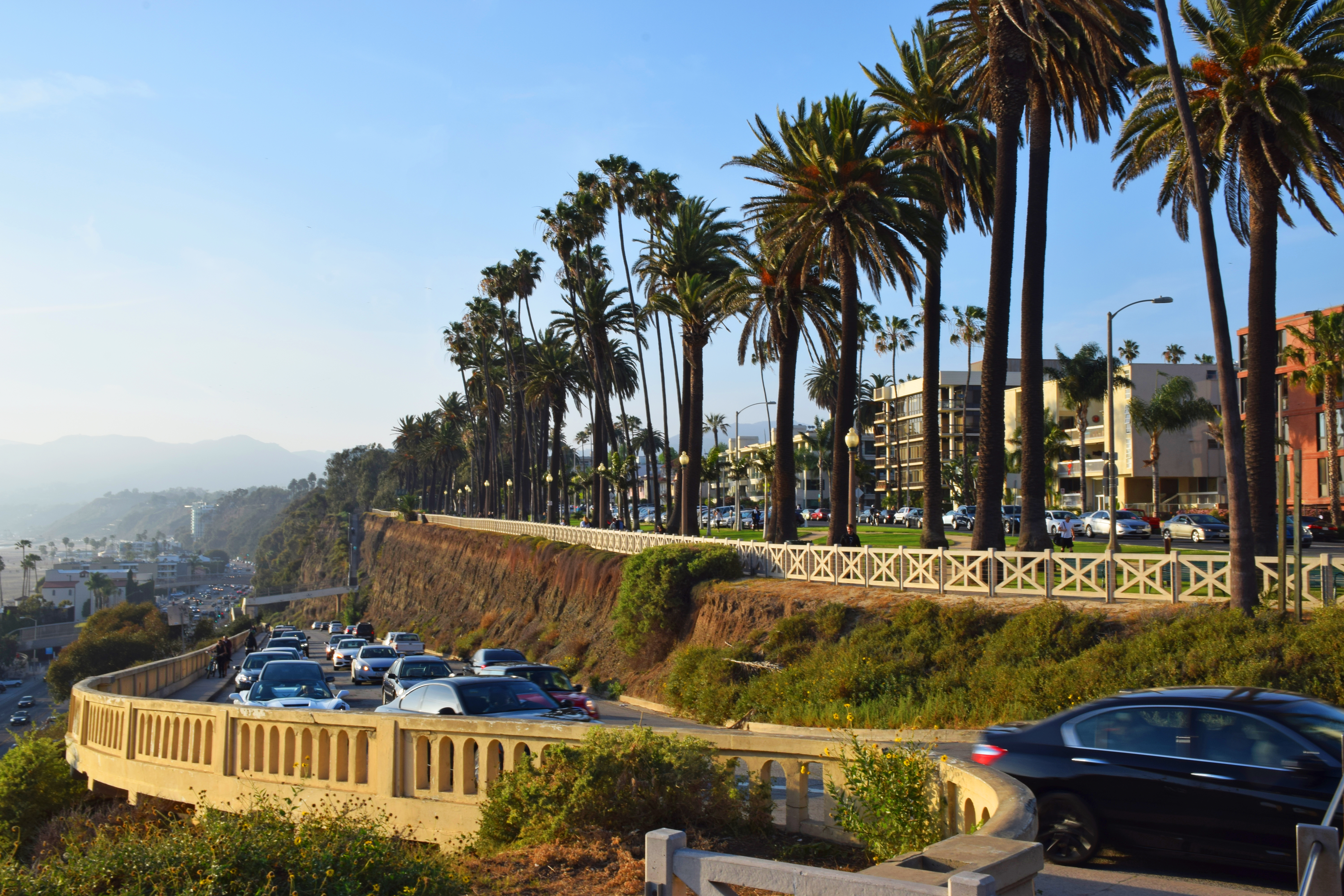
Good-Bye, Old California Incline This is a view of the California Incline, the landmark slanted road that connects the top of Santa Monica’s Palisades bluffs with the Pacific Coast Highway down below. It’s very familiar to those of us who visit Palisades Park regularly, and to motorists who use it daily to access the PCH from the city and vice-versa. You may have seen it in one of the movies shot in Santa Monica, or in postcards of the city. I have photographed it dozens of times and it never gets old!
That is, until now… In April, the incline bridge, built in the 1890s as a pedestrian route to the beach, will be demolished and replaced by a new structure, as part of a seismic retrofit 85 years in the making. The last renovation happened in 1930 to help make way for cars.
While the new structure will be safer, with a wider sidewalk and bicycle lanes, this will be a long project (some 12-18 months of construction). Traffic will be a nightmare in other areas of the city, and parts of the relatively quiet and pleasant Palisades Park will be disturbed by the noise of construction works.
But what intrigues me the most in all this is the fact that, having been in the LA area for only three-and-a-half years, I am already witnessing changes in its landmarks. I can almost hear myself saying, years from now: “before they demolished the old incline bridge…”
Yes, time really flies, and things just keep on changing…